We turn laser scanning into a living integrity record.
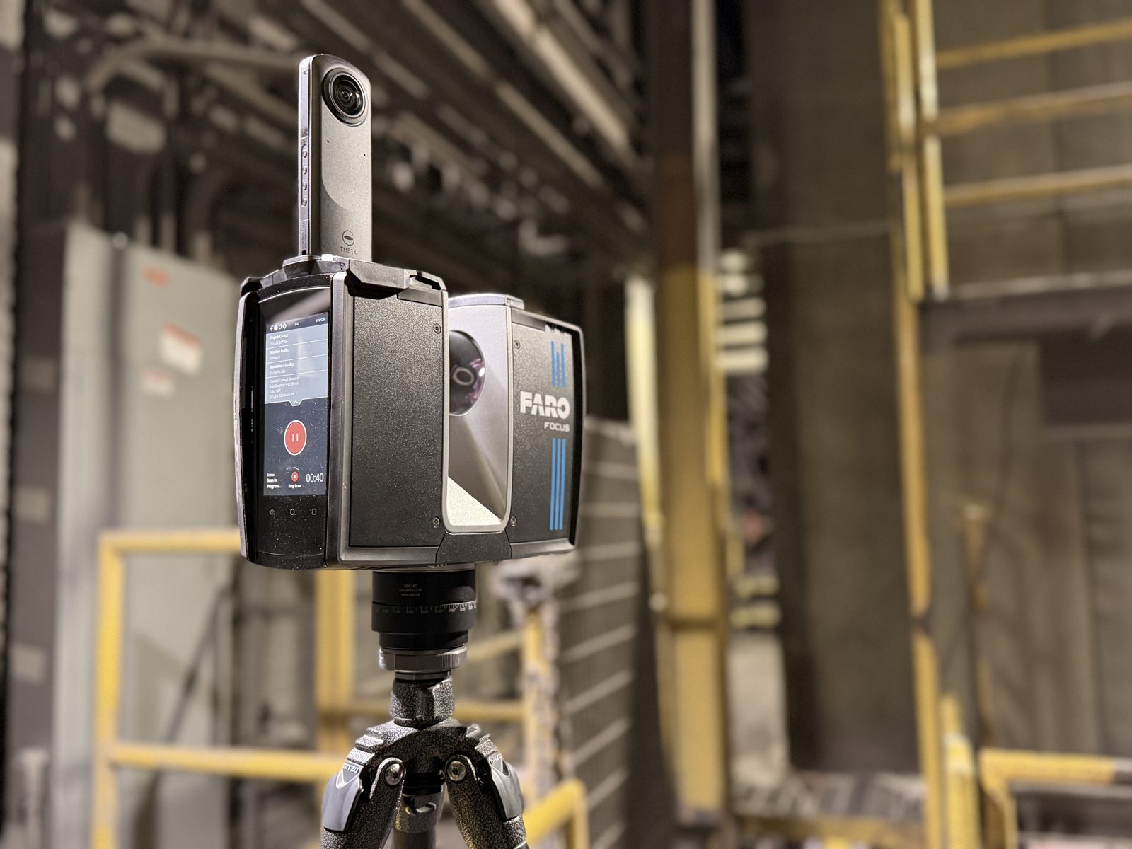
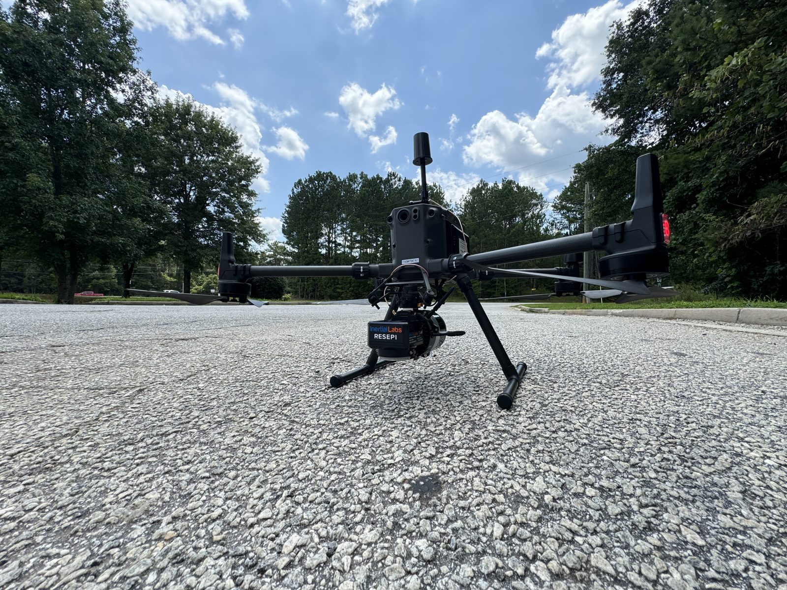
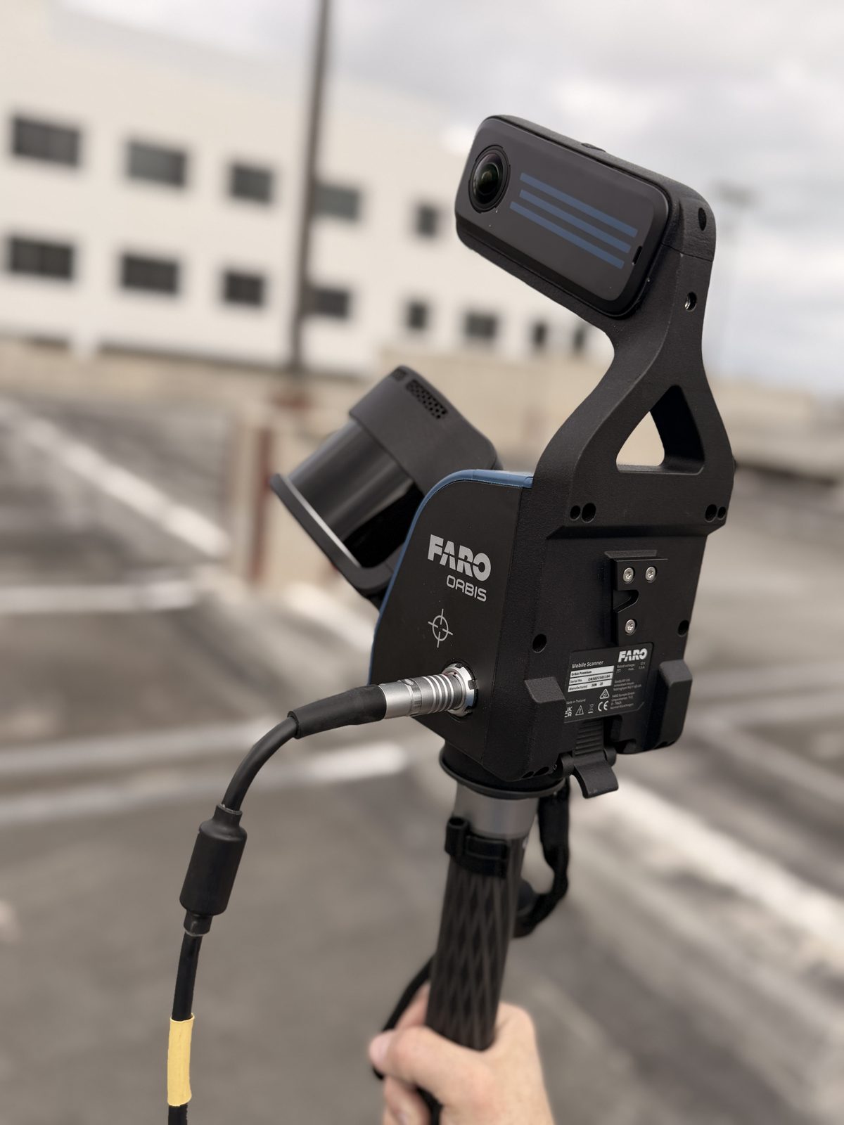
Static TLS scanners, drone aerial LiDAR & mobile SLAM-based LiDAR. We have every tool necessary to capture all aspects of your project at survey-grade accuracy.
Registered point clouds and Scan-to-BIM as-builts your design and engineering teams build from ... the foundation of an accurate digital twin.
Re-scan on a cadence. Watch every asset trend. See movement early, so your team acts before it becomes a problem.
Actual reality capture from the field ... press play.
Reality capture in the field
We flip that. By capturing a registered baseline and re-scanning on a cadence, condition becomes a trend line you can forecast against. The value compounds: year one is a baseline, year three is a forecasting tool, year five is an integrity record nobody can easily replace.
A registered, survey-grade capture of every critical asset, fixed to real coordinates and elevations.
Re-scan on a schedule. Deformation, settlement, and wear trended against the limits your engineers set.
Project the measured trend of each asset, so maintenance is scheduled and budgeted, not triggered by a surprise.
Millimeter-accurate LiDAR capture of buildings, plants, and infrastructure. We bring the equipment and the operator experience.
Explore →
Point clouds converted into intelligent, coordinated Revit models at the LOD your project demands.
Explore →
A photoreal, navigable replica of your site ... LiDAR-accurate and true to life, explored in your browser. Not a model ... the real thing.
Explore →
Ongoing monitoring of industrial assets ... tanks, kilns, vessels, stacks, structures ... tracked over time inside the IQ Platform.
Explore →
20+ years and 500+ projects across the built environment ... from live industrial plants to the buildings people work, learn, and stay in.
Each module is a repeatable capture-and-trend program for a class of critical asset, delivered into one dashboard your reliability team lives in.
Track refractory wear and remaining lining thickness over campaigns.
Shell distortion, edge and bottom settlement, API-653 style trending.
Shell ovality, axial alignment, and deformation tracked per survey.
Bulge, growth, and cyclic deformation captured and trended.
Verticality, lean, and structural movement monitored over time.
Settlement and displacement of racks, supports, and steel.
Liner thickness, wear rate, and change-out planning for mills, chutes, and hoppers.
BIM Blueprint is led by a reality-capture practitioner with 25+ years in construction, 20+ years of scanning, 500+ projects, and hands-on operation of TLS, drone, and mobile SLAM LiDAR across industrial, factory, commercial, storage, retail, schools, office, hospitality, civil, and corporate projects. When you trust an integrity decision to a scan, the operator credibility is the point.
We capture from a safe distance ... which cuts down on confined-space entry and work at height ... and we follow your site's safety requirements. Certificate of insurance available on request, and we complete site safety orientation and contractor prequalification (ISNetworld, Avetta, and the like) as your facility requires.
Start with one asset or one site. We'll scan it, model it, and show you exactly what it looks like inside the IQ Platform.